Tag Archives: flood maps

Flood Risk Score Set for Every American Home

01 Sep
flooding-fort-lauderdal-fl

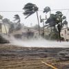
Hurricane Irma hit and flooded streets in Fort Lauderdale, FL Starting this week, the nonprofit research and technology group, First Street Foundation is launching an interactive website that offers flood risk data on over 142 million homes and properties across the country. This allows, homeowners and homebuyers the ability to check a forward-looking analysis of […]

Your Flood Insurance Q&A Guide

16 Jul
flood-insurance-adjuster

Home Insurance adjuster examining flood damage in the aftermath of Hurricane Sandy on November 11, 2012 in Far Rockaway, NY Floods are both the most common and most expensive natural disaster that hit the United States. According to the Federal Emergency Management Agency (FEMA), flood damage ends up costing an average of $8.2 billion every […]

Federal Flood Maps Versus New Flood Mapping Reports

13 Jul
cost-of-natural-disasters

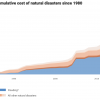
Within the United States, flooding is the most expensive natural disaster with cost over $1 trillion in inflation adjusted dollars since the year 1980. According to new calculations, the flood risk across many states in the country is far greater than current government estimates show. This threat could grow as climate change gets worse.  First […]

Coastal Homeowners in Denial: FEMA urges homeowners to buy flood insurance

23 Sep
fema

Congress is getting ready to send President Donald Trump the thirteenth 60-day extension of the National Flood Insurance Program (NFIP) as the current one expires at the end of September. The NFIP has been in serious financial trouble for years but Congress has been unable to agree on how to fix the ailing program.  The […]